Realistic Atmosphere
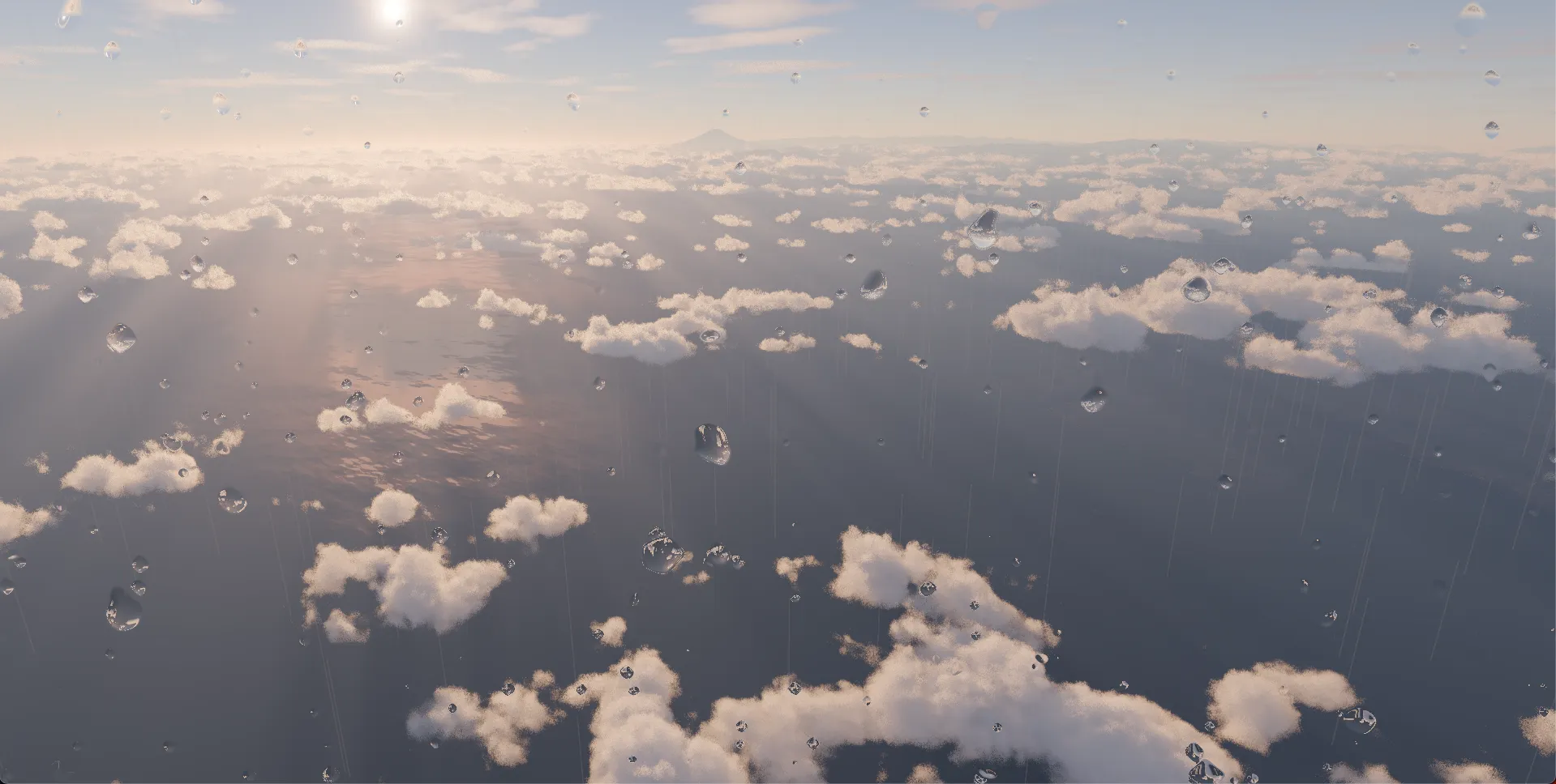
Achieve more realistic visual rendering using atmospheric effects.
What you will learn in this tutorial:
- Adding Aerial Perspective effects
- Configuring sky, sun, and star descriptors
- Adding cloud effects
- Setting up tone mapping and anti-aliasing
- Adding rain and snow effects
- Configuring water surface materials (using GSI MVT data)
Adding the Aerial Perspective Effect
Section titled “Adding the Aerial Perspective Effect”Aerial Perspective applies a haze and atmospheric depth effect based on distance. Using DefaultPlugin, all default descriptors are registered, and addDefaultPhotorealScene() sets up a photorealistic scene in one call.
import ThreeView, { JAPAN_GSI_ELEVATION_DECODER } from "@navaramap/three";import { DefaultPlugin, type DefaultDescriptions } from "@navaramap/three-default-plugin";
const plugin = new DefaultPlugin();const view = new ThreeView<DefaultDescriptions>({ shadow: true });view.addPlugin(plugin);await view.init();
// Set up a photorealistic scene in one call (sky, sunlight, stars, atmospheric effects, tone mapping, anti-aliasing, etc.)const layers = plugin.addDefaultPhotorealScene();
// Adjust Aerial Perspective as neededlayers.aerialPerspective.update({  aerialPerspective: {    irradiance: true, // Deferred lighting (required for displaying cloud shadows)  },});
const photoSource = view.addSource({  // Credit:  // - Geospatial Information Authority of Japan Tiles - Latest Nationwide Photo (Seamless)  //   https://maps.gsi.go.jp/development/ichiran.html  type: "raster-tile",  url: "https://cyberjapandata.gsi.go.jp/xyz/seamlessphoto/{z}/{x}/{y}.jpg",  maxZoom: 23,});view.addLayer({  type: "raster",  source: photoSource,});
const terrainSource = view.addSource({  // Credit:  // - Geospatial Information Authority of Japan Tiles - Digital Elevation Map  //   https://maps.gsi.go.jp/development/ichiran.html  type: "raster-dem",  url: "https://cyberjapandata.gsi.go.jp/xyz/dem_png/{z}/{x}/{y}.png",  elevationDecoder: JAPAN_GSI_ELEVATION_DECODER(),  minZoom: 6,  maxZoom: 15,});view.addLayer({  type: "terrain",  source: terrainSource,  terrain: {    castShadow: true,    receiveShadow: true,  },});
view.addLayer({  type: "raster",  source: terrainSource,  hillshade: {},});
view.setCamera({ lng: 139.7511, lat: 35.6736, height: 400, heading: -100, pitch: -20, roll: 0 });
With addDefaultPhotorealScene(), atmospheric descriptors such as sky, sunlight, stars, and skylight probe are also automatically added. To cast shadows, update the sunlight settings.
layers.sun.update({ sun: { castShadow: true } }); // Cast shadowsSetting Up Tone Mapping and Anti-Aliasing
Section titled “Setting Up Tone Mapping and Anti-Aliasing”Configure tone mapping, exposure, and anti-aliasing for a natural HDR look.
// Tone mappinglayers.toneMapping.update({ toneMapping: { mode: ToneMappingMode.AGX } });view.toneMappingExposure = 10; // Adjust according to the scene
// Anti-aliasing// addDefaultPhotorealScene() automatically selects SMAA for desktop and FXAA for mobile optimization
Adding Cloud Effects
Section titled “Adding Cloud Effects”Overlaying volumetric cloud effects enhances the sense of realism. Start with the default settings and adjust shadows and density as needed.
const clouds = view.addEffect<CloudsEffectDesc>({  clouds: {},});
// Example: Enable cloud shadowsclouds.update({ clouds: { shadows: true } });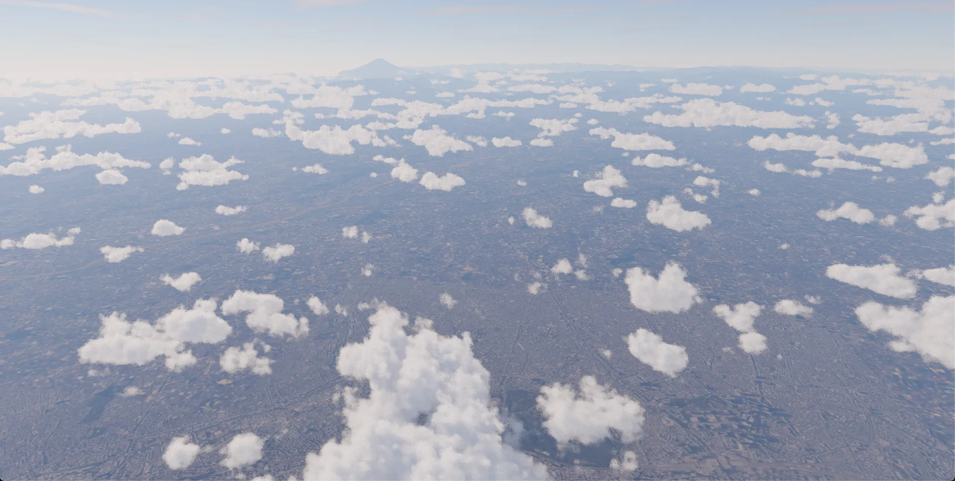
Adding Rain Effects
Section titled “Adding Rain Effects”Rain effects use a combination of two objects. RainMeshDesc renders 3D raindrop particles in the scene, and RainDropEffectDesc provides a post-processing effect of water droplets on the screen.
3D Raindrop Particles
Section titled “3D Raindrop Particles”// Enable the animation loop to keep rain animation runningview.animation = true;
// Add rain objectconst rain = view.addMesh<RainMeshDesc>({ rain: { particleCount: 5000, // Number of raindrops speed: 0.0015, // Fall speed opacity: 1.0, // Opacity width: 3, // Raindrop width height: 60.0, // Raindrop length areaWidth: 500, // Rainfall area width (m) areaHeight: 1000, // Rainfall area height (m) maxHeight: 10000, // Maximum rainfall area height (m) },});Screen Water Droplet Effect
Section titled “Screen Water Droplet Effect”A post-processing effect that simulates water droplets adhering to the camera lens during rainy weather.
const rainDropEffect = view.addEffect<RainDropEffectDesc>({ rainDrop: { opacity: 0.8, // Overall effect opacity dropGridSize: 14, // Water droplet grid size dropDensity: 0.1, // Water droplet density dropSizeFactor: 0.025, // Water droplet size factor },});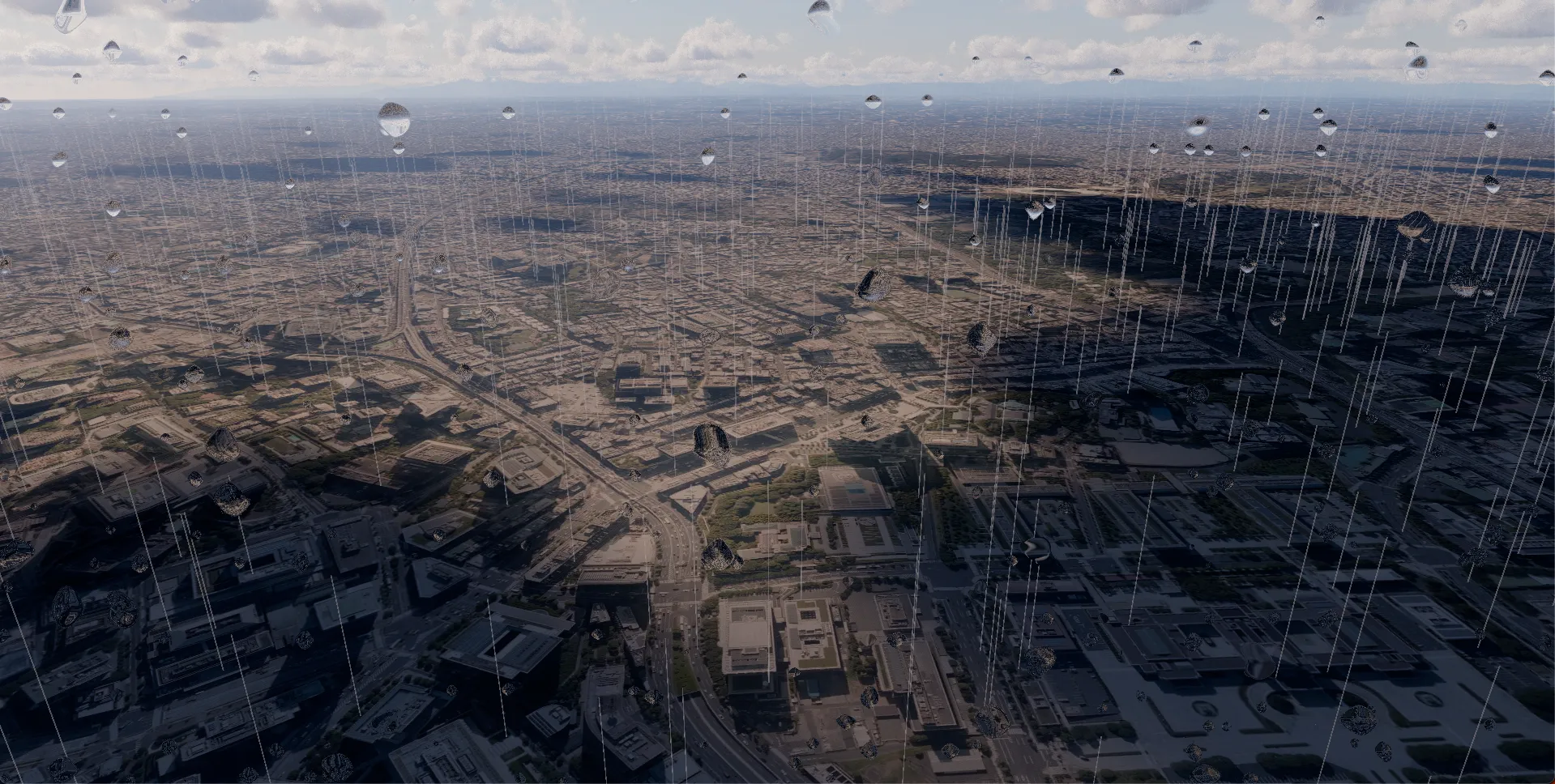
Adding Snow Effects
Section titled “Adding Snow Effects”For snow effects, use SnowMeshDesc. Remove the rain object and add it instead.
// Add snow objectconst snow = view.addMesh<SnowMeshDesc>({ snow: { particleCount: 5000, // Number of snowflakes speed: 0.00005, // Fall speed size: 10, // Snowflake size opacity: 1, // Opacity areaWidth: 500, // Snowfall area width (m) areaHeight: 1000, // Snowfall area height (m) maxHeight: 3000, // Maximum snowfall area height (m) // Wind-driven sway movementStrength: { x: 50, y: 20, z: 50 }, // Sway amplitude for each axis movementSpeed: { x: 0.0005, y: 0.0002, z: 0.0005 }, // Sway speed for each axis },});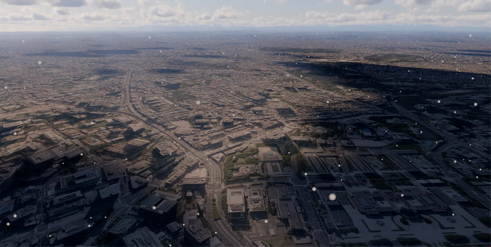
Adding Water Surface Materials (GSI MVT Data)
Section titled “Adding Water Surface Materials (GSI MVT Data)”The Geospatial Information Authority of Japan’s experimental vector tiles (experimental_bvmap) include water area data such as rivers and lakes. Using the water: true option applies a water surface material with ripples.
// Add water area layer from GSI experimental vector tilesconst waterSource = view.addSource({  // Credit: Geospatial Information Authority of Japan Vector Tile Experimental Service  // https://github.com/gsi-cyberjapan/gsimaps-vector-experiment  type: "vector-tile",  url: "https://cyberjapandata.gsi.go.jp/xyz/experimental_bvmap/{z}/{x}/{y}.pbf",  maxZoom: 16,});view.addLayer({  type: "vector",  source: waterSource,  sourceLayers: ["waterarea"], // Use only the water area layer  polygon: {    color: new Color().setStyle("#001e0f"),    reflectivity: 0.2,    // Reflectivity    clampToGround: true,  // Clamp to terrain    water: true,          // Enable water surface material  },});
view.atmosphere.date = new Date("2026-01-01T16:00:00+09:00"); // January 1, 16:00 JSTview.setCamera({ lng: 140.0372145462, lat: 35.6059411903, height: 3880, heading: -98.4184014976, pitch: -18.0000012192, roll: 0 });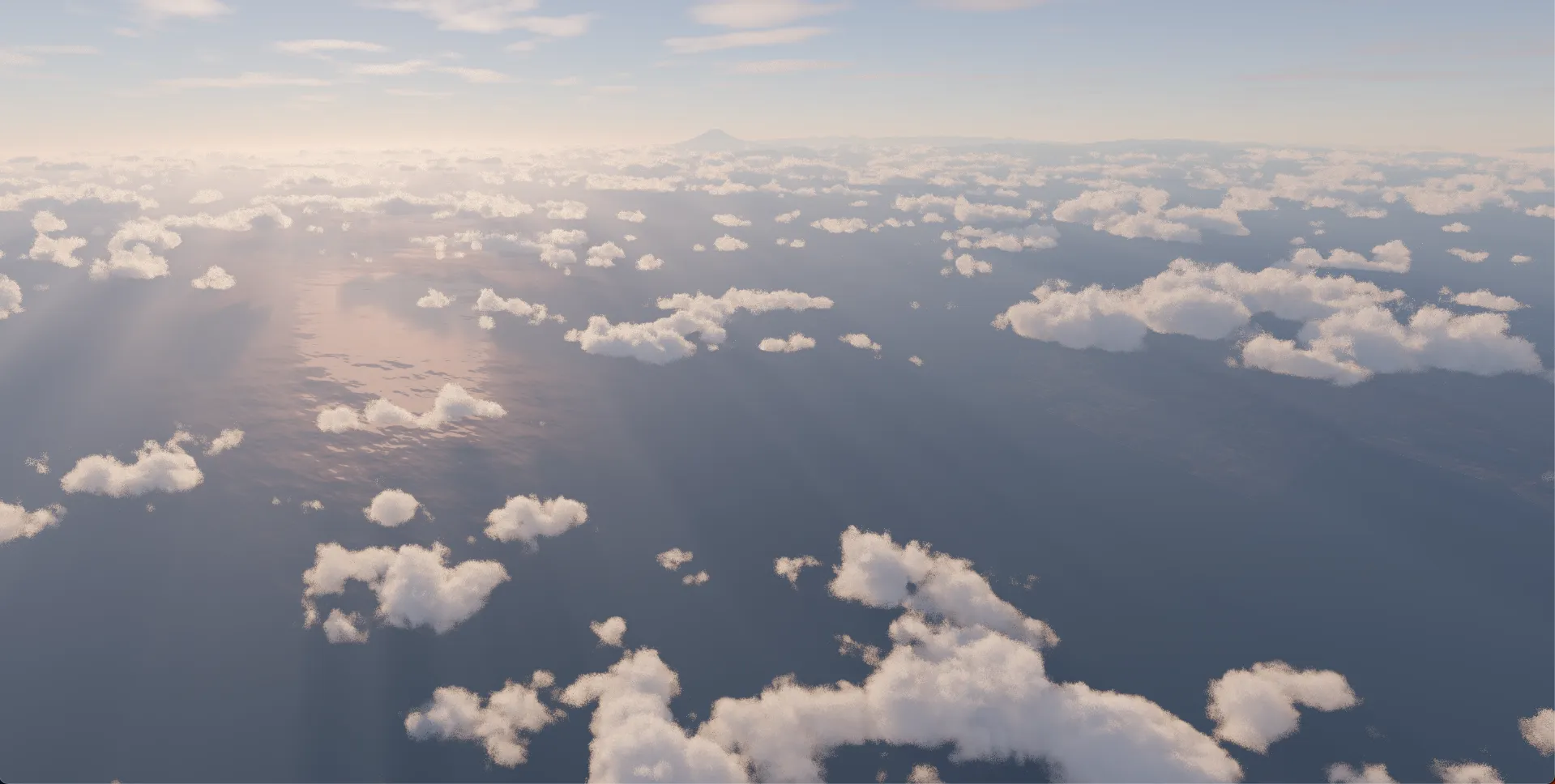
Combining with SSR (Screen Space Reflections)
Section titled “Combining with SSR (Screen Space Reflections)”Adding SSREffectDesc enables real-time reflections of buildings and other objects on the water surface.
// Add PLATEAU building modelsconst plateauSource = view.addSource({  // Credit:  // - 3D City Model (Project PLATEAU) Chiyoda Ward (FY2023) - MLIT PLATEAU  //   https://www.geospatial.jp/ckan/dataset/plateau-13101-chiyoda-ku-2023  type: "3d-tiles",  url: "https://assets.cms.plateau.reearth.io/assets/db/070026-aa27-431b-8d53-7cc6b03244f8/13101_chiyoda-ku_pref_2023_citygml_1_op_bldg_3dtiles_13101_chiyoda-ku_lod2_no_texture/tileset.json",});view.addLayer({  type: "3d-tiles",  source: plateauSource,  model: {    show: true,    color: new Color().setStyle("#ffffff"),    metalness: 0,    roughness: 0.5,    height: -50, // Adjust ellipsoidal height    castShadow: true,    receiveShadow: true,  },});
// Add SSR effectview.addEffect<SSREffectDesc>({  ssr: {},});
view.atmosphere.date = new Date("2026-01-01T12:00:00+09:00"); // January 1, 12:00 JST
view.setCamera({  lng: 139.7511145474829,  lat: 35.67364356091717,  height: 902.0,  heading: 64.41840149763287,  pitch: -36.00000121921312,  roll: 0,});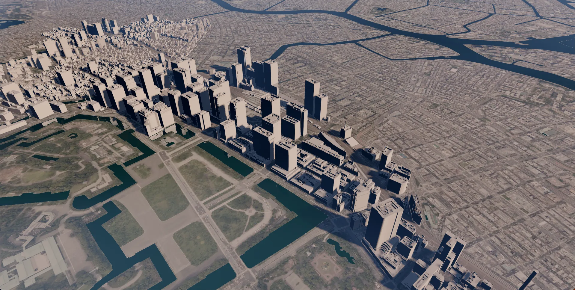
Complete Example
Section titled “Complete Example”Below is a complete example combining atmospheric effects, rain, and water surface materials.
import ThreeView, { Color, JAPAN_GSI_ELEVATION_DECODER } from "@navaramap/three";import { type CloudsEffectDesc, type RainDropEffectDesc, type RainMeshDesc, type SnowMeshDesc, type SSREffectDesc, ToneMappingMode } from "@navaramap/three-default-descs";import { DefaultPlugin, type DefaultDescriptions } from "@navaramap/three-default-plugin";
const plugin = new DefaultPlugin();const view = new ThreeView<DefaultDescriptions>({  shadow: true,  animation: true,  waterTexture: {    enabled: true  },});view.addPlugin(plugin);await view.init();
// Set up a photorealistic scene in one callconst layers = plugin.addDefaultPhotorealScene();
// Adjust Aerial Perspective as neededlayers.aerialPerspective.update({  aerialPerspective: {    irradiance: true, // Deferred lighting (required for displaying cloud shadows)  },});
const photoSource = view.addSource({  // Credit:  // - Geospatial Information Authority of Japan Tiles - Latest Nationwide Photo (Seamless)  //   https://maps.gsi.go.jp/development/ichiran.html  type: "raster-tile",  url: "https://cyberjapandata.gsi.go.jp/xyz/seamlessphoto/{z}/{x}/{y}.jpg",  maxZoom: 23,});view.addLayer({  type: "raster",  source: photoSource,});
const terrainSource = view.addSource({  // Credit:  // - Geospatial Information Authority of Japan Tiles - Digital Elevation Map  //   https://maps.gsi.go.jp/development/ichiran.html  type: "raster-dem",  url: "https://cyberjapandata.gsi.go.jp/xyz/dem_png/{z}/{x}/{y}.png",  elevationDecoder: JAPAN_GSI_ELEVATION_DECODER(),  minZoom: 6,  maxZoom: 15,});view.addLayer({  type: "terrain",  source: terrainSource,  terrain: {    castShadow: true,    receiveShadow: true,  },});
view.addLayer({  type: "raster",  source: terrainSource,  hillshade: {},});
layers.sun.update({ sun: { castShadow: true } }); // Cast shadows
// Tone mappinglayers.toneMapping.update({ toneMapping: { mode: ToneMappingMode.AGX } });view.toneMappingExposure = 10; // Adjust according to the scene
const clouds = view.addEffect<CloudsEffectDesc>({  clouds: {    qualityPreset: "high"  },});
// Enable cloud shadowsclouds.update({ clouds: { shadows: true } });
view.addMesh<RainMeshDesc>({  rain: {    particleCount: 5000, // Number of raindrops    speed: 0.0015,             // Fall speed    opacity: 1.0,         // Opacity    width: 3,          // Raindrop width    height: 60.0,          // Raindrop length    areaWidth: 500,       // Rainfall area width (m)    areaHeight: 1000,      // Rainfall area height (m)    maxHeight: 10000,       // Maximum rainfall area height (m)  },});
view.addEffect<RainDropEffectDesc>({  rainDrop: {    opacity: 0.8,           // Overall effect opacity    dropGridSize: 14,       // Water droplet grid size    dropDensity: 0.1,       // Water droplet density    dropSizeFactor: 0.025,  // Water droplet size factor  },});
// Add water area layer from GSI experimental vector tilesconst waterSource = view.addSource({  // Credit: Geospatial Information Authority of Japan Vector Tile Experimental Service  // https://github.com/gsi-cyberjapan/gsimaps-vector-experiment  type: "vector-tile",  url: "https://cyberjapandata.gsi.go.jp/xyz/experimental_bvmap/{z}/{x}/{y}.pbf",  maxZoom: 16,});view.addLayer({  type: "vector",  source: waterSource,  sourceLayers: ["waterarea"], // Use only the water area layer  polygon: {    color: new Color().setStyle("#001e0f"),    reflectivity: 0.02,    // Reflectivity    clampToGround: true,  // Clamp to terrain    water: true,          // Enable water surface material  },});
// Add PLATEAU building modelsconst plateauSource = view.addSource({  // Credit:  // - 3D City Model (Project PLATEAU) Chiyoda Ward (FY2023) - MLIT PLATEAU  //   https://www.geospatial.jp/ckan/dataset/plateau-13101-chiyoda-ku-2023  type: "3d-tiles",  url: "https://assets.cms.plateau.reearth.io/assets/db/070026-aa27-431b-8d53-7cc6b03244f8/13101_chiyoda-ku_pref_2023_citygml_1_op_bldg_3dtiles_13101_chiyoda-ku_lod2_no_texture/tileset.json",});view.addLayer({  type: "3d-tiles",  source: plateauSource,  model: {    show: true,    color: new Color().setStyle("#ffffff"),    metalness: 0,    roughness: 0.5,    height: -50, // Adjust ellipsoidal height    castShadow: true,    receiveShadow: true,  },});
// Add SSR effectview.addEffect<SSREffectDesc>({  ssr: {  },});
view.atmosphere.date = new Date("2026-01-01T16:00:00+09:00"); // January 1, 16:00 JST
view.setCamera({ lng: 140.0372145462, lat: 35.6059411903, height: 3880, heading: -98.4184014976, pitch: -18.0000012192, roll: 0 });